Custom Wall Maps
Categories
- Aeronautical Charts (3636)
- International Topo Maps (26059)
- USGS Topographic (65052)
- Nautical, Geologic (1058)
- Soviet Military Maps (22771)
- Wall Maps (165)
- |_ Arctic Region NRC (1)
- |_ Burkina Faso Cities (2)
- |_ Cameroon Cities (5)
- |_ China Mountain Series (9)
- |_ Ecuador Cities and Cotopaxi (4)
- |_ El Salvador Cities (13)
- |_ El Salvador Departments (7)
- |_ France Wine (11)
- |_ Maldives (2)
- |_ Pakistan Cities (19)
- |_ Custom Wall Maps (92)
Custom Wall Maps
Product Image
Product Name-
Price
Regional Relief - Northern South America
These beautiful maps show Political and Physical features for Northern South America; from Venezeula in the north to Bolivia in the south. Maps...
$37.50
... more info
Regional Relief - Russian Federation
These beautiful maps show Political and Physical features for the Russian Federation; from the Baltic States in the west to Japan and Korea in the...
$37.50
... more info
Regional Relief - Southeastern Asia
These beautiful maps show Political and Physical features for Southeast Asia; from India in the west to Papua New Guinea in the east. Maps contain...
$37.50
... more info
Regional Relief - Southern Africa
These beautiful maps show Political and Physical features for Southern Africa; from the Gulf of Guinea and Ethiopia in the north to South Africa in...
$37.50
... more info
Regional Relief - Southern Europe
These beautiful maps show Political and Physical features for Southern Europe; from Spain and Portugal in the west, to Ukraine and Turkey in the...
$37.50
... more info
Regional Relief - Southern South America
These beautiful maps show Political and Physical features for Southern South America from; Paraguay and Uruguay in the north, to the Falkland Islands...
$37.50
... more info
Regional Relief - United Kingdom & Ireland
These beautiful maps show Political and Physical features for the United Kingdom, Ireland as well as Benelux in mainland Europe. Maps contain...
$37.50
... more info
Regional Relief - United States
These beautiful maps show Political and Physical features for the lower 48 U.S. States. Maps contain extensive country specific features and text....
$37.50
... more info
Rockies-Okanagan
Create custom regional maps in Canada from this series of attractive detailed road maps covering most of the populated areas across Canada. Maps are...
$21.99
... more info
Southern Alberta and Saskatchewan
Create custom regional maps in Canada from this series of attractive detailed road maps covering most of the populated areas across Canada. Maps are...
$21.99
... more info
Southern Ontario - Durham
Create custom street maps in Montreal centred on your business, home or other key point of interest. Maps are developed from Lucidmap’s iconic...
$21.99
... more info
Southern Ontario - Halton
Create custom street maps in Montreal centred on your business, home or other key point of interest. Maps are developed from Lucidmap’s iconic...
$21.99
... more info
Southern Ontario - Hamilton
Create custom street maps in Montreal centred on your business, home or other key point of interest. Maps are developed from Lucidmap’s iconic...
$21.99
... more info
Southern Ontario - Niagara
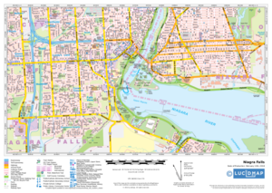
Create custom street maps in Montreal centred on your business, home or other key point of interest. Maps are developed from Lucidmap’s iconic...
$21.99
... more info
Southern Ontario - Peel
Create custom street maps in Montreal centred on your business, home or other key point of interest. Maps are developed from Lucidmap’s iconic...
$21.99
... more info
Southern Ontario - Toronto-York
Create custom street maps in Montreal centred on your business, home or other key point of interest. Maps are developed from Lucidmap’s iconic...
$21.99
... more info
Southern Saskatchewan
Create custom regional maps in Canada from this series of attractive detailed road maps covering most of the populated areas across Canada. Maps are...
$21.99
... more info
Spain Topographic
This topographic map of Spain shows features including cities and towns, highways with labels, major roads, streets, pathways, railways, train and...
$19.99
... more info
Tactical Pilotage Charts
Published by the United States government in the 1980s and 1990s, Tactical Pilotage Charts are topographic maps with detailed aeronautical...
$30.00
... more info
UK Electoral Constituencies
These maps highlight the electoral geography of the United Kingdom. Clearly visible Electoral Constituency boundaries and names are overlain on an...
$106.25
... more info
UK Local - Fixed Scale
Detailed national mapping based on Ordnance Survey Vector Map Local data. Accurate, large scale mapping at a fixed scale of 1:5, 000. Rich urban...
$97.50
... more info
UK Roads
A multi-scale Road map product based on Ordnance Survey data and cartographic styles. Make a map of anywhere in England, Scotland and Wales. This...
$25.00
... more info
UK Street View
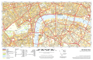
This product provides Ordnance Survey street-level mapping that has been specifically designed to cartographically emphasize road carriageways, road...
$25.00
... more info
UK Topographic
This product provides Ordnance Survey mapping for your leisure activities and outdoor recreation pursuits. Create maps for anywhere in the United...
$25.00
... more info
US Travelers Atlas - Alaska
Alaska Regional data based on a 1:5 million scale dataset. Perfect for the creation of regional and state level maps. Includes highways, cities &...
$30.00
... more info
US Travelers Atlas - Continental US
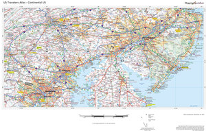
U.S. Regional data based on a 1:1 million scale dataset. Perfect for the creation of regional and state level maps. Includes highways, cities &...
$30.00
... more info
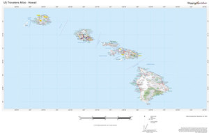
US Travelers Atlas - Hawaii
Hawaii Regional data based on a 1:1 million scale dataset. Perfect for the creation of regional and state level maps. Includes highways, cities &...
$30.00
... more info
USA Explorer
This versatile product allows you to get a topo map of anywhere in the USA. It has been designed so you can create a map for your next outdoor...
$25.00
... more info
USA Political
This USA map clearly depicts all the cities, major roads and also shows all the state areas and boundaries.
$56.25
... more info
USA Streets
The MapSherpa Street product is ideal for the Business owner who needs local or regional road network information within a service delivery,...
$61.25
... more info
USA Streets Index
The MapSherpa Street product is ideal for the Business owner who needs local or regional road network information within a service delivery,...
$61.25
... more info
USA Terrain
This versatile product allows you to get a wall map of anywhere in the USA. It has been designed to create beautiful maps that emphasize the natural...
$22.50
... more info
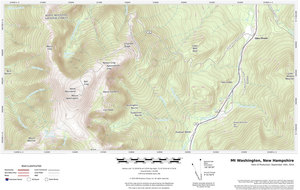
USA Topo - Modern
This product is derived from the modern USGS Topographic series updated on a 3 year cycle, and allows for the creation of detailed modern topographic...
$12.50
... more info
USA ZIP Codes
Custom 5-Digit ZIP Code maps can be made for anywhere in America. These attractive and informative maps include extensive geographic detail...
$59.99
... more info
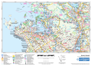
Vancouver - Agassiz
Create custom street maps in Montreal centred on your business, home or other key point of interest. Maps are developed from Lucidmap’s iconic...
$21.99
... more info
Western New Brunswick
Create custom regional maps in Canada from this series of attractive detailed road maps covering most of the populated areas across Canada. Maps are...
$21.99
... more info
Western Ontario
Create custom regional maps in Canada from this series of attractive detailed road maps covering most of the populated areas across Canada. Maps are...
$21.99
... more info
World Imagery
Based on Mapbox Satellite which provides highly-detailed imagery for the whole world. Appropriate for mapping starting at 1:10, 000 and up.
$48.75
... more info
World Imagery Hybrid
Based on Mapbox Satellite with OpenStreetMap street visualization for the whole world. Appropriate for mapping starting at 1:10, 000 and up.
$48.75
... more info
World Physical
This physical map displays relief features on the earth by colouring the land elevations and water depths. International boundaries, major towns and...
$25.00
... more info
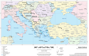
World Political
This political world map features countries marked in different colours, with international and regional boundaries shown. Major towns and cities are...
$25.00
... more info
World Political with Relief
This political world map features countries marked in different colours, with international and regional boundaries shown. A hill shading texture...
$25.00
... more info
Copyright © 2025 Charts and Maps. Powered by Zen Cart
![Charts and Maps [home link] (image for) Charts and Maps [home link]](includes/templates/rca/images/candm-logo.png)


